



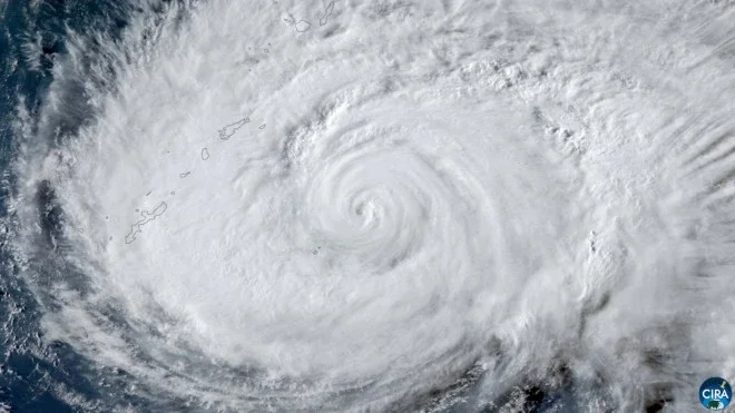
A powerful Typhoon No. 13 is battering Japan's Okinawa main island and the Amami region, bringing torrential rain, violent winds, and waves exceeding 8 meters.
As of 1 p.m. on August 7, the typhoon was located about 50 kilometers north of Nago, Okinawa Prefecture, moving west at 25 km/h while maintaining strong intensity.
The storm has a central pressure of 940 hectopascals, with maximum sustained winds of 40 meters per second and gusts reaching 55 meters per second.
Heavy rain bands continue to sweep across Okinawa and Amami, while wind gusts exceeding 40 meters per second have been recorded in several locations. Coastal waters remain extremely dangerous, with waves rising above 8 meters.
Forecasters say the typhoon will continue moving west but is expected to slow down later on August 7. The slower movement could keep Okinawa under severe weather conditions for a longer period, with heavy rain, destructive winds, and rough seas likely to continue through the night and into August 8.
Authorities have urged residents to stay indoors, avoid coastal areas, and closely follow official weather advisories as the dangerous conditions persist.