



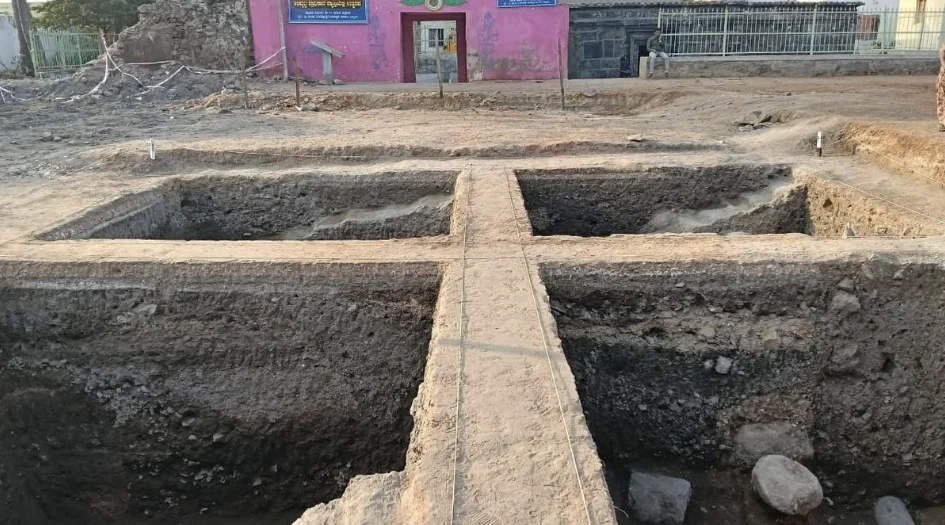
A New Exploration of Lakkundi’s History
Lakkundi, in Karnataka’s Gadag district, is an important centre of medieval South Indian history and architecture. The region is particularly known for its temples, stepwells and other structures associated with the Western Chalukyan period.
Researchers believe that the visible monuments may represent only part of the archaeological remains in the area. Some structures could have been covered over time by soil, vegetation or later development.
How LiDAR Technology Can Help
LiDAR stands for Light Detection and Ranging. It uses laser pulses to create highly detailed three-dimensional representations of the terrain.
When mounted on drones or other aerial platforms, LiDAR systems can collect information about the ground surface by measuring the time taken for laser signals to return. The resulting data can reveal variations in elevation and other subtle features that may indicate human-made structures.
Detecting Structures Hidden Under Vegetation
Ancient sites such as Lakkundi can contain archaeological remains that are difficult to identify through ordinary visual surveys. Trees, bushes, soil and natural changes to the landscape may conceal the outlines of old structures.
LiDAR can help researchers identify small changes in the terrain. These could provide clues about buried walls, foundations, old pathways or other archaeological features.
Beyond Temples
Lakkundi’s heritage extends beyond its famous temples. Ancient stepwells, water-management structures, settlement remains, pathways and other public or domestic structures could provide valuable information about the region’s historical development.
If the survey identifies new archaeological features, researchers could gain a better understanding of how the ancient settlement was organised and how its residents managed water, housing and public spaces.
Technology Adds a New Dimension to Archaeology
Traditional archaeological research often depends on excavation and detailed physical surveys. However, extensive excavation across a large historical landscape can be expensive, time-consuming and potentially disruptive to heritage remains.
LiDAR can help researchers first identify areas that may contain archaeological features. This can allow future investigations and excavations to be more focused and evidence-driven.
Supporting Heritage Conservation
The survey could also play an important role in documenting Lakkundi’s heritage digitally. Mapping the location and extent of archaeological features can create a valuable record for future conservation and site management.
Detailed terrain data could help authorities understand where heritage structures may exist and assist in planning conservation measures, visitor infrastructure and broader heritage-management strategies.
Potential for New Historical Evidence
Discovering previously unknown structures could offer researchers fresh insights into Western Chalukyan architecture, settlement patterns, water management and everyday life.
Combining LiDAR findings with existing archaeological and historical evidence could help create a more comprehensive picture of how Lakkundi developed as an important medieval settlement.
Conclusion
The planned LiDAR survey of Lakkundi could become an important step in Karnataka’s archaeological and heritage research. By using modern technology to identify features that remain hidden beneath vegetation or soil, researchers may be able to uncover previously undocumented chapters of the region’s history.
Beyond archaeological discovery, the survey could provide valuable digital data for conserving Lakkundi’s monuments and managing the historic site for future generations.